The term “bug out bag” may be new to you especially if you have not seen any information about preppers or survivalists. The name is used to describe…
Bug Out Bags – What are They and Do I Need One?

The term “bug out bag” may be new to you especially if you have not seen any information about preppers or survivalists. The name is used to describe…
Bug Out Bags – What are They and Do I Need One?


Plants that absorb radiation, including EMF radiation, can be an important part of your whole-house EMF protection strategy. As a bonus, many of …
9 Plants That Absorb Radiation For Easy EMF Protection

This is an Eruption update for Tuesday, November 29th at 10 in the morning.
USGS – Hawaiian Volcano Observatory reports the leading edge of the lava flow on Mauna Loa’s northeast flank remains at a high elevation of over 9,000 feet and more than 5 miles from Saddle Road.
As stated, the northeast flank of Mauna Loa is not populated and lava continues to not pose a threat to any communities or infrastructure, at this time.
Due to no threat to communities at this time, shelters that were opened yesterday at Old Kona Airport in Kailua-Kona and Ka`u Gymnasium in Pahala as a precaution, will be closed at noon today.
For those traveling Saddle Road /Daniel K. Inouye Highway, parking along the highway is unsafe and prohibited. Hawaii Police Department report that vehicles that park along Saddle Road /Daniel K. Inouye Highway between the 16 and 31 Mile Markers will be subject to citation and will be towed.
You will be informed of any changes that affect your safety.
This is your Hawaii County Civil Defense Agency.Confirm Receipt© 2022 Everbridge, Inc.

Measure you doorways and windows that you want to leave open to get fresh air.

Go to your hardware store and pick up HVAC Filters. They have various sizes. I used 20 x 25 on the doors and 16x 20 for the windows. You need 2 pieces of wood 1“x 2” x 8 feet per door. Windows I just used the duct tape

Tools you’ll need. Duct tape, scissors, utility knife, tape measure, filters.
Doorway: Cut your wood to the correct size. Lay the wood down and stick the filters in between the 2 pieces of wood. Measure both sides so it is even or your pañal will be crooked. Tape each side length wise first and flip it over and tape. Then tape each individual panel and go around the wood.
You won’t need wood for the windows. Just tape the panels together after measuring.


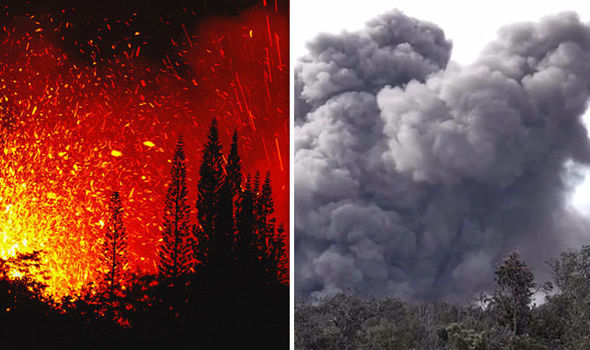
THE HEALTH HAZARDS OF VOLCANIC ASH (part 6 Precautions for Children)
THE HEALTH HAZARDS OF VOLCANIC ASH (part 6 Precautions for Children)
— Read on orgnatlife.com/2018/05/30/the-health-hazards-of-volcanic-ash-part-6-precautions-for-children/
This is an Eruption message for Monday, November 28th at 12:30 AM.

USGS – Hawaiian Volcano Observatory reports an eruption at the summit of Mauna Loa is occurring.
USGS – Hawaiian Volcano Observatory and Civil Defense are activated and monitoring the situation.
The eruption is confined to the summit of Mauna Loa and there are no lava flow threats to communities and there is no evacuation requested at this time.
You will be informed of any changes that affect your safety.
This is your Hawaii County Civil Defense Agency.Confirm Receipt© 2022 Everbridge, Inc.


If you are one of the few that come home to one of the burnt out neighborhoods make sure you exercise caution while out in the elements.
Your home and residing in the neighborhood: Set up an area that you can seal off. If you have a separate hall way that you can close off with plastic or a separate entry, perhaps through the side garage door(not a big one)with door to house. Handy to change contaminated clothes.
Even though your area may not have flames crawling up your street or that you can actually see, remember embers and ash can float through the air. It will glide until it gets caught on a branch or something to cling onto.
Open your pores with warm water and use a good scrubby or washcloth with loads of soap. Soap up really good. Use cold water after to wash the soap off and close your pores.
Keep all of your smoke clothes in a plastic bag in your sealed area until you wash them. You don’t want to spread the smell or contaminate any other area.
If you are in close vicinity of the devastated areas: Do Not run any fans or air conditioning that has a connetion to outdoors. Close all doors, windows and vents. Close blinds and curtains to keep sun out and temperatures down in the house.

Are the rich running away from the earth? It seems Global Warming Is Inevitable No Matter What We Do, it’s just not working.
Experts claim rising of the earth’s temperature due to the increasing concentration of greenhouse gases. It is a result of human activities which include burning of fossil fuels and clearing forests for various purposes. All the plastic that we have feed into the oceans and landfills. All the pollution created by humans. We have fed our world nothing but garbage, Literally…

India’s Heatwave is melting the roadways.
Some scientists claim that the earth’s core is heating up and possible implosion could happen. Is the earth going to melt or swallow its self?
There are sink holes opening around the world. The largest sinkhole in the world is the Qattara Depression near Cairo, Egypt. The sinkhole, which is filled with sludge and quicksand, measures almost 50 miles (80 kilometers) long and 74 miles (120 kilometers) wide. Florida’s sinkholes have swallowed cars to humans.
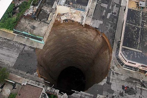
There are many large sink holes in the USA. More are appearing every day.
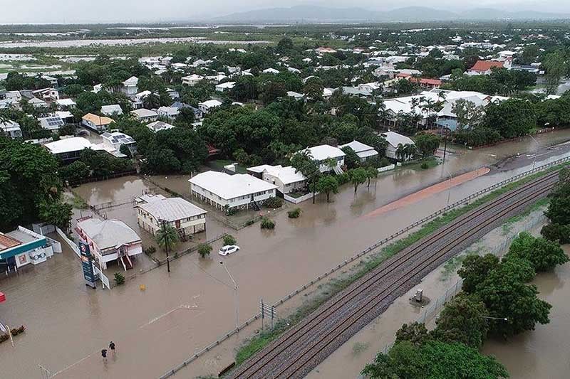
Countries around the world are being flooded out. People homes are destroyed and they are homeless. USA floods have taken many homes and has left hundreds of thousands homeless.

The Pacific ring of fire, earthquakes, tornados, hurricanes, cyclones, wild fires, flooding, sand tornados. Entire towns are being wiped off the map.The entire world is being devastated. So is this related to the great race for space. Are those conspiracies reality for today and our future. Something to ponder on. Controlling the weather.

So as you will see there is a race to get you into space. That’s If you have the money of course. The cost of a private flight into space starts at a mere $200,000.00 up to $175 million. So pack your sunscreen your going to the moon….
2019 has got a whole list of exciting missions and launches.
There are so many exciting space events scheduled for 2019. From manned launches to scientific missions and the private sector of the space industry.
January
January 1 NASA’s New Horizons spacecraft arrives at the distant Solar System object Ultima Thule.
January 3, China makes history by the landing of its Chang’e 4 rover on the far side of the Moon.
February
NASA’s InSight lander continues drilling into the surface of Mars. Collecting samples of the Red Planet.
NASA’s Juno spacecraft performed a close flyby of Jupiter on February 12,
February 21 SpaceX Falcon 9 rocket was launched to take a lunar lander built by Israeli company SpaceIL to the Moon.
March
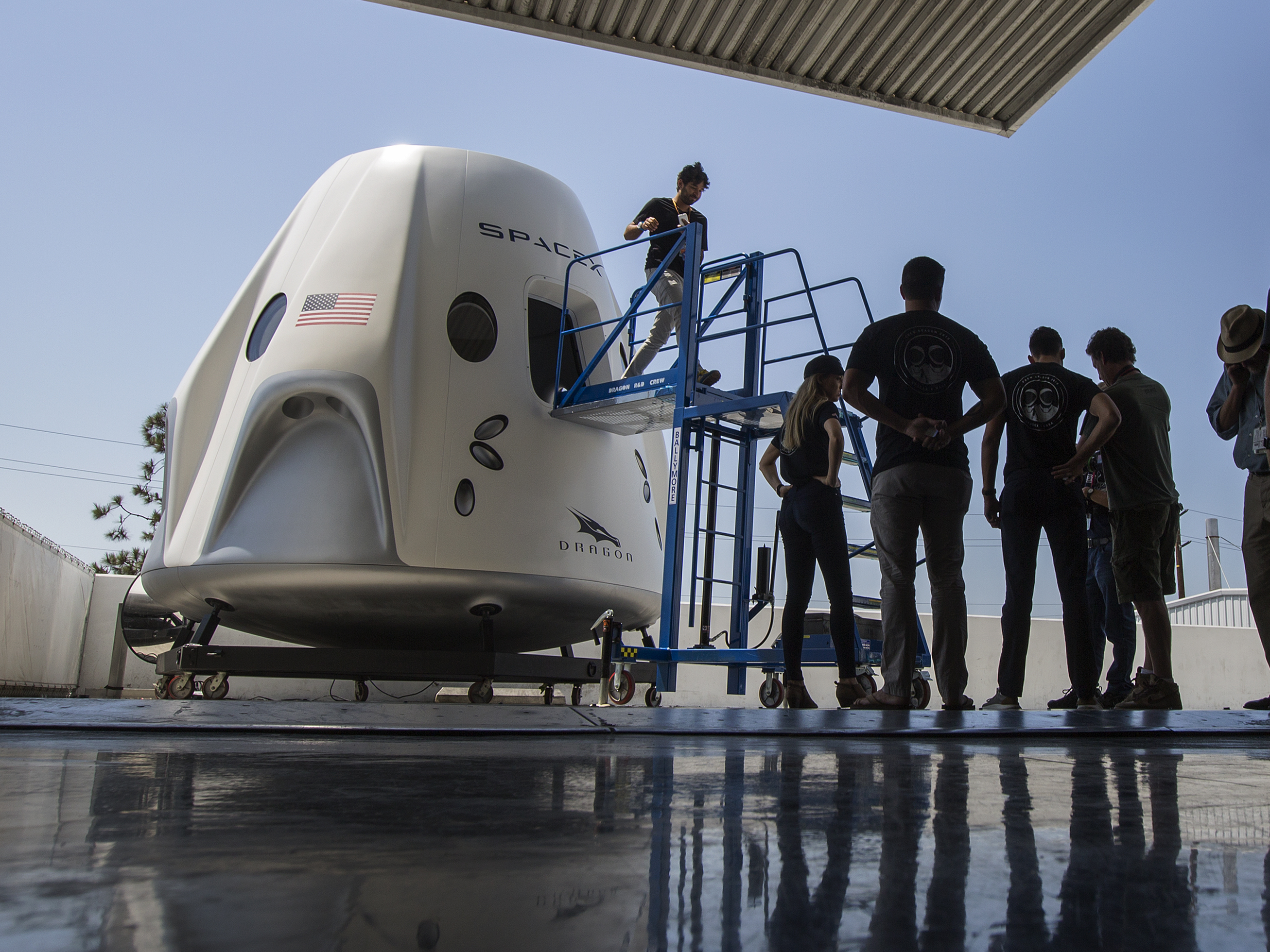
March 2 SpaceX has launched its crewed Dragon 2 spacecraft on its first test. This was an un-manned flight.
April
April 4 NASA’s Parker Solar Probe will make its next close approach to the Sun
April 11 SpaceX launched its second Falcon Heavy rocket, the launch of the Arabsat-6A spacecraft for Saudi Arabia.
May
May 23 SpaceX will use a Falcon 9 rocket to launch a batch of satellites for the company’s Starlink broadband.
May 27 A Russian Soyuz rocket will launch the Glonass M navigation satellite.
May 29 Russian cosmonauts Oleg Kononenko and Alexey Ovchinin will take a spacewalk outside the International Space Station
May 30 Russian Proton rocket will launch the Yamal 601 communications satellite for Gazprom Space Systems.
June
In June, we are expecting to see the first crewed launch of SpaceX’s Dragon 2 vehicle
June 3 The SpaceX Dragon CRS-17 cargo spacecraft will undock from the International Space Station.
June 5 China will attempt its first rocket launch from the sea
June 11 SpaceX Falcon 9 rocket will launch the Canadian Space Agency’s Radarsat Constellation Mission.
June 12 Ascent Abort-2: NASA will conduct a test of the Orion spacecraft’s Launch Abort System
June 20: An Ariane 5 rocket provided by Arianespace will launch the DirecTV 16 and Eutelsat 7C communications satellites.
June 20 Elon Musk says that SpaceX will perform a test flight of its Starship vehicle, intended to one day take humans to Mars.
June 21 Russian Proton rocket will launch the Spektr-RG X-ray observatory.
June 22 A SpaceX Falcon Heavy rocket will launch the U.S. Air Force’s Space Test Program-2 mission.
June 24 Three Expedition 59 crewmembers will return to Earth after spending more than 6 months at the International Space Station.
June 27 A United Launch Alliance Atlas V rocket will launch the fifth Advanced Extremely High Frequency (AEHF) satellite for the U.S. military.
Also scheduled to launch in June (from Spaceflight Now):
Rocket Lab will launch multiple small satellites into orbit on a rideshare mission arranged by Spaceflight. The mission, titled “Make It Rain,” will launch on an Electron rocket.
A Russian Rockot rocket will launch three Gonets M communications satellites from the Plesetsk Cosmodrome in Russia.
A Russian Soyuz rocket will launch the Russian Arktika-M 1 weather and communications satellite from the Baikonur Cosmodrome in Kazakhstan.oth on their third spaceflight.
July
July 5 Russian Soyuz rocket will launch with the Meteor M2-2 polar-orbiting weather satellite and 40 small satellites.
July 9 India will launch the Chandrayaan-2 mission to the moon.
July 8 SpaceX Falcon 9 rocket will launch the Dragon cargo spacecraft (CRS-18) on a mission to the International Space Station.
July 16 Russian Proton rocket will launch the Blagovest No. 14L communications.
July 20 50th anniversary of the Apollo 11 moon landing.
July 20 Three new Expedition 60 crewmembers will launch to the International Space Station in the Soyuz MS-13 spacecraft:
July 24 Arianespace will use an Ariane 5 ECA rocket to launch the Intelsat 39 communications satellite for SSL and the EDRS-C communications satellite for OHB System AG.
July 25 Crew Dragon Demo 2: SpaceX’s Crew Dragon spacecraft is scheduled to take its first manned test flight to the International Space Station.
July 25 United Launch Alliance Delta 4 rocket will launch the second GPS 3 satellite for the U.S. Air Force’s Global Positioning System.
July 31 Russia will launch a Progress cargo spacecraft on a mission to deliver cargo to the International Space Station.
Also scheduled to launch in July (from Spaceflight Now):
SpaceX will use a Falcon 9 rocket to launch the Amos 17 communications
Japan will launch the HTV-8 cargo resupply mission to the International Space Station
China will launch the Shijian 20 communications satellite
Arianespace will use a Vega rocket to launch the Falcon Eye 1 Earth-imaging satellite for the United Arab Emirates.
August
Aug. 1 Virgin Orbit’s LauncherOne rocket will launch 14 cubesats for NASA and other educational institutions for the ELaNa-20 rideshare mission.
Aug. Virgin Orbit’s LauncherOne rocket will launch 14 cubesats for NASA and other educational institutions for the ELaNa-20 rideshare mission.
Possible first contracted crew flight of SpaceX’s Dragon 2 in August, providing the test flight sticks to schedule. USCV-1 to the International Space Station (ISS).
Boeing will conduct an uncrewed test flight of its CST-100 Starliner vehicle at some point in August with plans for a first crewed test Flight.
September
Sept. 2 Arianespace Vega rocket will launch on the Small Spacecraft Mission Service (SSMS) proof-of-concept mission with multiple small satellites.
Sept. 25 Three new Expedition 61 crewmembers will launch to the International Space Station in the Soyuz MS-15 spacecraft.
Also scheduled to launch in September (from Spaceflight Now):
Japan will launch the HTV-8 cargo resupply mission to the International Space Station.
NASA’s OSIRIS-Rex spacecraft will swoop down to the surface of the asteroid Bennu in September and try to collect a sample.
October
Oct. 3 NASA astronaut Nick Hague, Russian cosmonaut Alexey Ovchinin and Hazzaa Ali Almansoori of the United Arab Emirates will return to Earth from the International Space Station.
Oct. 15 Arianespace Soyuz rocket will launch the first COSMO-SkyMed Second Generation (CSG 1) radar surveillance satellite for the Italian space agency. Flying as a secondary payload is the European Space Agency’s Characterizing Exoplanet Satellite (CHEOPS.
Oct. 19 Northrop Grumman will launch the Cygnus NG-12 cargo mission to the International Space Station.
Also scheduled to launch in October (from Spaceflight Now):
A SpaceX Falcon 9 rocket will launch the third GPS 3 satellite for the U.S. Air Force’s Global Positioning System.
A new planet-hunting mission from ESA will launch between October 15 and November 14. It’s called CHEOPS (Characterising Exoplanets Satellite), and it’ll look for planets orbiting bright stars close to our Solar System.
November
Also scheduled to launch in November (from Spaceflight Now):
Boeing’s CST-100 Starliner will launch on its first crewed test flight to the International Space Station.
An Arianespace Vega rocket will launch the United Arab Emirates’ Falcon Eye 2 Earth observation satellite.
December
Boeing’s CST-100 Starliner will launch on its first crewed test flight to the International Space Station.
Richard Branson’s Virgin Orbit company plans to send its first rocket to space sometime in 2019.
2018 Launches
March 1 GOES-S on an Atlas 5-541 rocket from Space Launch Complex 41 at Cape Canaveral Air Force Station
March 20 TESS on a Falcon 9 rocket from Space Launch Complex 40
May 5 InSight on an Atlas 5-401 rocket from Space Launch Complex 3-East.
July 31 Parker Solar Probe on a Delta 4-Heavy rocket from Space Launch Complex
Sept. 12 ICESat 2 on a Delta 2-7420 rocket from Space Launch Complex 2-West.
To be determined: ICON on an air-launched Pegasus XL rocket staged from Kwajalein Atoll, Marshall Islands


Check out Ikaika Marzo on Facebook Click Here
Phillip Ong on Youtube Click Here

Wow Life goes on here on the Big Island of Hawaii.
Several lava fissures starting to re-open.
More Lava at the shoreline coming, maybe from old lava tubes.
Pele is headed a little North west from what we have heard last few days
Today we have loud thunder or explosions. Big Clouds over the East Rift Zone.

With so many natural disasters with in the past few years taxing FEMA’s piggy bank, what happens when its all gone?
What will America do when FEMA is broke? Do you have home owners insurance or renters insurance to cover your damages?
Just to name a few places. Texas, Hawaii, Louisiana, Florida, New York, New Jersey, East Coast, West Coast fires and Mudslides, Earth Quakes, Extended weather, unusual tornadoes and hurricane seasons are becoming more familiar everyday.
FEMA’s Budget 13.9 Billion dollars has been set aside for 2018
We are only into 6 months of the year and the balance left is $21 million at the end of May 2018. That does not include Hawaii’s Volcano Eruption.


Nothing, No-one, nor any animal or wild life is exempt from the vapors and / or ashes. Who ever is in the path of the downfall will be severally burned and death is usually imminent.
Animals who inhale or ingest volcanic ash are at risk for fluoride poisoning. This could cause internal bleeding, long-term bone damage and teeth loss.
Cows, sheep, goats and horses should be rounded up and put in a closed barn, provided with hay and clean water until the ash dissipated.
Birds were also affected by the volcano. The ponds became heavy with mud and they were unable to fly because their wings were covered with ash.
Guidelines for pet owners concerning animal health after a volcano:
“Pet owners should limit the amount of time that they and their animals spend outside if they detect the ash and consult a vet if they have any concerns about the health of their pets.”
Make sure that you bathe your pet often in Luke warm. Keep any wounds covered and dry. Change bandages everyday for any wounds.
Fine Glass textured ash can cut the lungs if inhaled. Keep all pets in doors or completely covered and out of the elements as well as possible.
I know that the ASPCA steps up during all Natural Disasters to rescue all animals. I have witnessed that first hand during a volcano eruption 15 miles from my home. They came and rescued trapped animals with trucks, trailers and by helicopter. Please help this organization that really does their job…

As you all know by now, on the Big Island of Hawaii on May 3, 2018 we had an volcano eruption. Leilani Estates was the first Subdivision to be affected. Many animals at that time were left behind. Some had no choice but to leave their pets.
This community has come together with many volunteers. They have activated their own search and rescue efforts. The Rescue Agency pay for all the gas, food and any other expenses. Now with donations starting to come in has made a big improvement for the rescue animals. People have taken animals into their homes for temporary housing. Everyone is pitching in where they can. The Rescue Agency’s are full. Some have erected temporary structures to house the animals.
![]()

The Hawaiʻi Lava Flow Animal Rescue Network (HLFARN) was created to serve as an informational hub for those needing assistance with pets and animals on farms during the 2018 eruption of Kilauea on the Big Island of Hawaiʻi. But it has become so much more than that. HLFARN has blossomed from a group of strangers into an Ohana; a family of people whose love for animals has taken them into the path of an erupting volcano to rescue pets and farm animals that have been left behind.

![]()
![]()


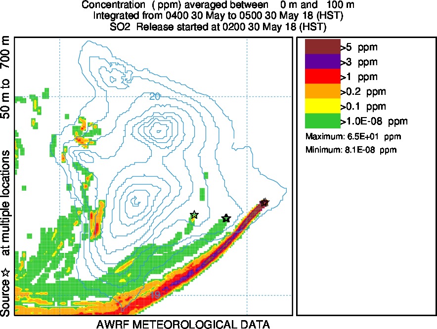
The Vog Measurement and Prediction Project (VMAP) provides real-time vog forecasts. With the help of our project collaborators vog forecasts are available to the public through this web site. Comments and inquiries can be directed to the appropriate contact. We welcome constructive comments from all VMAP users, and strive to provide the best possible service consistent with our mission and resources. Inquiries into actual measured values and concerns regarding hazardous conditions should be directed to the appropriate agency such as the Hawaii State Department of Health. The VMAP website is intended to be complementary to the data provided by other state and federal agencies.
Vog is primarily a mixture of sulfur dioxide (SO2) gas and sulfate (SO4) aerosol. SO2 (invisible) reacts with oxygen and moisture in the air to produce SO4 aerosol (visible). SO2 is expected to be the main problem in areas near the vent (Hawai`i Volcanoes National Park, Pahala, Na`alehu, Hawaiian Ocean View Estates) and SO4 aerosol is expected to be the main problem at locations far from the vent (Kona and farther north and west). For more information on vog visit the FAQ page here.
The links and material on this page are provided to summarize findings about the effects of vog on health.
How vog affects human health is the topic of active research. Children and those with pre-existing lung conditions are the most vulnerable to its effects. Some studies show that children and those with pre-existing respiratory problems are more likely to visit a medical clinic or emergency room during vog episodes. Although vog exposure has not been shown to cause childhood asthma, it has been shown to aggravate asthma in those already diagnosed with the condition.
When exposed to vog, some people report eye, nose, throat, and/or skin irritation, coughing and/or phlegm, chest tightness and/or shortness of breath, headache, and increased susceptibility to respiratory ailments. Some people also report fatigue and/or dizziness. One researcher also found vog is associated with high blood pressure. Another researcher found a link to anxiety. More detail on the health effects on vog can be found in the References section, or by visiting the International Volcanic Health Hazard Network.

This document has been prepared by the International Volcanic Health Hazard Network (IVHHN), Cities and Volcanoes Commission, GNS Science and the United States Geological Survey (USGS) to promote the safety of those who experience volcanic ashfall. This guide explains the potential health effects of volcanic ash and gives details on how to protect yourself and your family in the event of a volcanic ash fall.

The most effective way to reduce exposure, especially for people with particular susceptibilities (e.g., children and infants, older people and those with existing respiratory (lung) or cardiovascular (heart and blood vessels) disease) is to shelter somewhere which is not ashy, ideally inside a building where you can stay indoors for some time, if necessary. If you are very concerned about your health, take advice from a health professional.
Take steps to keep ash out of your indoor environment:
If you are staying indoors for a long time:
Once the ash has settled, it important to remove it through clean-up activities, using water to dampen it first. You must wear a face mask if you are cleaning up settled ash.
If you cannot remove yourself from the ash, you may wish to use some sort of respiratory protection (e.g., face mask), or may be advised to do so by governmental or humanitarian agencies. Masks may be worn when:
1) you are outdoors and there is ash in the air (either during ash fall or afterwards, when it may be remobilized by wind, vehicles and human activities);
2) ash is being mobilized indoors or outdoors by activities such as removal/cleaning-up.
Masks can be worn during waking hours. It is not recommended to wear a face mask while sleeping as it will probably not stay fitted to the face, and it is harder to breathe with a face mask on.
People with existing respiratory or cardiovascular disease should talk to a health professional about whether facemasks are suitable. Care should be taken to ensure that it is not harder to breathe when using any form of respiratory protection.
Masks are not usually designed to fit children’s faces (although some manufacturers are now producing small masks aimed at children but not infants). Exposure for children and infants should be reduced by staying in a non-ashy (indoor) environment wherever possible. If you do give a mask to a child, show the child how to fit it well, and be very careful it does not make breathing difficult.
The following information will help you decide on which type of respiratory protection to use, but other factors, such as the cost and availability of the protective products, may also need to be taken into account.
When you wear respiratory protection, the effectiveness depends particularly on two factors:
1) how effective the mask or material is at filtering particles (stopping the ash from passing through the material);
2) the fit of the mask or material to the face (preventing particles from entering around the edges).


This document has been prepared by the International Volcanic Health Hazard Network (IVHHN), Cities and Volcanoes Commission, GNS Science and the United States Geological Survey (USGS) to promote the safety of those who experience volcanic ashfall. This guide explains the potential health effects of volcanic ash and gives details on how to protect yourself and your family in the event of a volcanic ash fall.
To minimize potential eye irritation:
If symptoms persist you should seek advice from your doctor or optometry.
 THE HEALTH HAZARDS OF VOLCANIC ASH (part 3 SKIN)

This document has been prepared by the International Volcanic Health Hazard Network (IVHHN), Cities and Volcanoes Commission, GNS Science and the United States Geological Survey (USGS) to promote the safety of those who experience volcanic ashfall. This guide explains the potential health effects of volcanic ash and gives details on how to protect yourself and your family in the event of a volcanic ash fall.
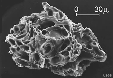 Volcanic ash is composed of fine particles of fragmented volcanic
 Eruptions can also generate thunder and lightning from
 Medical services can expect an increase in the number of patients
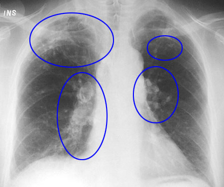
 THE HEALTH HAZARDS OF VOLCANIC ASH (part 2 EYES)
This document has been prepared by the International Volcanic Health Hazard Network (IVHHN), Cities and Volcanoes Commission, GNS Science and the United States Geological Survey (USGS) to promote the safety of those who experience volcanic ashfall. This guide explains the potential health effects of volcanic ash and gives details on how to protect yourself and your family in the event of a volcanic ash fall.
 Effects on roads
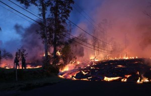 Effects on Power
 Effects on water supplies
 Effects on sanitation
 Risk Of Roof Collapse
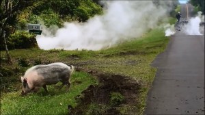 Animal Health
This document has been prepared by the International Volcanic Health Hazard Network (IVHHN), Cities and Volcanoes Commission, GNS Science and the United States Geological Survey (USGS) to promote the safety of those who experience volcanic ashfall. This guide explains the potential health effects of volcanic ash and gives details on how to protect yourself and your family in the event of a volcanic ash fall.

Protective Clothing should be worn when you are outdoors.
Depending on the type of volcano Kilauea is a basaltic shield volcano, erupting a type of basalt known as tholeiite. This type of lava is the dominant extrusive during the shield building (the main stage) of hawaiian volcanism and is the dominant basalt type erupted on Earth.
Pele’s hair is a form of lava. It is named after Pele, the Hawaiian goddess of volcanoes. It can be defined as volcanic glass fibers or thin strands of volcanic glass.[1] The strands are formed through the stretching of molten basaltic glass from lava, usually from lava fountains, lava cascades, and vigorous lava flows.
Pele’s hair is extremely light, so the wind often carries the fibers high into the air and to places several kilometers away from the vent. It is common to find fibers of Pele’s hair on high places like top of trees, radio antennas, and electric poles.
Pele’s hair does not only occur in Hawaii. It can be found near other volcanoes around the world, for example in Nicaragua (Masaya), Italy (Etna), Ethiopia (Erta’ Ale), and Iceland, where it is known as “nornahár” (“witches’ hair”).[2] It is usually found in gaps in the ground, mostly near vents, skylights, ocean entry, or in corners where Pele’s hair can accumulate.


It is not recommended to touch Pele’s hair, because it is very brittle and very sharp, and small broken pieces can enter the skin. Gloves should be worn while examining it.
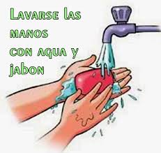
For those of you who have sensitive skin you should avoid skin contact with volcanic ash as it will cause an allergic reaction or also called dermatitis , if the volcanic ash already on your skin you should wash your skin with soap and clean water .
Although skin irritation are not always experienced by all people , but if the volcanic ash was mixed with harmful substances you should be careful , because it could be such a dangerous substance that can irritate your skin .
Some of the symptoms that occur to the skin due to volcanic ash
Some tips to prevent the bad effects of volcanic ash :
 THE HEALTH HAZARDS OF VOLCANIC ASH (part 4 Indirect health effects )
This document has been prepared by the International Volcanic Health Hazard Network (IVHHN), Cities and Volcanoes Commission, GNS Science and the United States Geological Survey (USGS) to promote the safety of those who experience volcanic ashfall. This guide explains the potential health effects of volcanic ash and gives details on how to protect yourself and your family in the event of a volcanic ash fall.
 Limit Driving
 Reduce ash in your house
Keep all doors and windows closed whenever possible.
Eye protection Drinking Water
 Home-grown food
 Clean Up


![]()
The Hawaiʻi Lava Flow Animal Rescue Network (HLFARN) was created to serve as an informational hub for those needing assistance with pets and animals on farms during the 2018 eruption of Kilauea on the Big Island of Hawaiʻi. But it has become so much more than that. HLFARN has blossomed from a group of strangers into an Ohana; a family of people whose love for animals has taken them into the path of an erupting volcano to rescue pets and farm animals that have been left behind.
![]()
![]()

Please check out the GOFUNDME page. https://www.gofundme.com/hlfarn

The Hawaiʻi Lava Flow Animal Rescue Network (HLFARN) was created to serve as an informational hub for those needing assistance with pets and animals on farms during the 2018 eruption of Kilauea on the Big Island of Hawaiʻi. But it has become so much more than that. HLFARN has blossomed from a group of strangers into an Ohana; a family of people whose love for animals has taken them into the path of an erupting volcano to rescue pets and farm animals that have been left behind.
We are a grassroots movement to help the residents displaced from Leilani Estates and lower Puna to evacuate their beloved companions and friends. As a group of volunteers, we have rescued over 200 animals thus far. We continue to help residents, their furry friends, and…
View original post 222 more words

The STRANGEST SMELL came over Hawaiian Paradise Park and Orchidland at 9:30 am this morning as these wispy strange looking clouds came over. I called my friend Lisa ask her if she smells a strange odor. Yes i smell that also.Then about 10:00 am military plane shows up going through all these clouds back and forth. I call my friend Lisa to tell her to look she is up mountain from me. she says yes i see. My face and lips were stinging when I came back in. The plane kept coming again and again. Don’t know what it was, but it made me cough and my skin is itchy too.
They keep down Playing the PGV (Puna Geothermal Venture Plant) facts. Those facts could kill the whole community in Puna district and then some. They really have no idea. It depends on a lot of factors: wind speed, cloud formation, height and weight, time of day, Day Or Night . So many factors and a lot of people are acting like “it’s all good, I got this”… “Do you really got this”.?


We sometimes think the change is rapid when it is time that has worn out the soles of our planet. The abuse that humans have inflicted upon this great earth we call home. A Great Chapter I see as closing before our very eyes.
Filmed January 23, 2016 around 10:45am PST.
SAY GOODBYE… Homes Fall Into Ocean In Pacifica Beach, Drone footage reveals erosion on Pacifica Coast, California.
San Francisco is falling apart at the ocean seams. Cliffside neighborhood in Pacifica that is threatened by erosion.
Esplanade Avenue in the San Francisco suburb are teetering on the cliff’s edge as other portions of the bluff appear to have disintegrated into the crashing waves below.


Needs To Be Used With A Fan, (Box / Square fan is best). At this point what ever you have will work. I am using a small VORNADO 40 and it is pulling cool air in just fine.
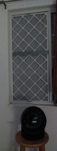
YOU NEED TO MEASURE YOUR WINDOWS OR DOORWAYS.
Head on over to the hardware store near you and pick up your HVAC AIR REPLACEMENT FILTERS, Duct Tape and a cutting utility knife (if you don’t have one)..


I bought the #9 rated filter. That was the highest rated the store had.
Actually the store was pretty empty as far as supplies goes. Plenty of people wanting and looking for solutions. I also wanted a indoor air conditioner and came up empty handed for those. Home Depot Hilo, Hawaii would not sell the floor models. Don’t understand their problem on that during a crisis. Sell what ever you can to the people is my motto.
Any how!!! Back to our important project…

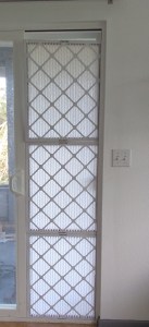
If you come up short by a couple of inches, you can cut a piece of cardboard and add it to the top with duct tape to the filter paper surface.

I did a couple larger than the opening and the fit was great that way also. This one filled up the entire window ledge opening. It is held by the shampoo bottle.


The wind blew hard and it bent. So I put a 1″x 2″ on each side and duct taped the wood to each side and then went across at the seams of filter connections with tape on both sides.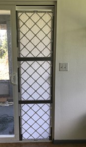
See how easy it is to protect yourself from minor pollutants…
***Just remember this is protection from Light smoke and ash only!!!***
You can also use this in a car or truck window if you are displaced by the volcano eruption.

Volcano: Kilauea (VNUM #332010)
Current Volcano Alert Level: WARNING
Current Aviation Color Code: ORANGE
Issued: Wednesday, May 9, 2018, 8:02 AM HST
Source: Hawaiian Volcano Observatory
Notice Number:
Location: N 19 deg 25 min W 155 deg 17 min
Elevation: 4091 ft (1247 m)
Area: Hawaii
Volcanic Activity Summary: The steady lowering of the lava lake in “Overlook crater” within Halemaʻumaʻu at the summit of Kīlauea Volcano has raised the potential for explosive eruptions in the coming weeks. If the lava column drops to the level of groundwater beneath Kīlauea Caldera, influx of water into the conduit could cause steam-driven explosions. Debris expelled during such explosions could impact the area surrounding Halemaʻumaʻu and the Kīlauea summit. At this time, we cannot say with certainty that explosive activity will occur, how large the explosions could be, or how long such explosive activity could continue.
Residents of the Kīlauea summit area should learn about the hazards of ashfall, stay informed of the status of the volcano and area closures, and review family and business emergency plans.
Resource on volcanic ash hazards: https://volcanoes.usgs.gov/volcanic_ash/
![]()
Remarks: HAZARDS
Primary hazards of concern should this activity occur are ballistic projectiles and ashfall.
BALLISTIC PROJECTILES
During steam-driven explosions, ballistic blocks up to 2 m (yards) across could be thrown in all directions to a distance of 1 km (0.6 miles) or more. These blocks could weigh a few kilograms (pounds) to several tons.
Smaller (pebble-size) rocks could be sent several kilometers (miles) from Halemaʻumaʻu, mostly in a downwind direction.
ASHFALL
Presently, during the drawdown of the lava column, rockfalls from the steep enclosing walls of the Overlook crater vent impact the lake and produce small ash clouds. These clouds are very dilute and result in dustings of ash (particles smaller than 2 mm) downwind.
Should steam-driven explosions begin, ash clouds will rise to greater elevations above ground. Minor ashfall could occur over much wider areas, even up to several tens of miles from Halemaʻumaʻu. In 1924, ash may have reached as high as 20,000 feet above sea level. Small amounts of fine ash from these explosions fell over a wide area as far north as North Hilo (Hakalau), in lower Puna, and as far south as Waiohinu.
GAS
Gas emitted during steam-drive explosions will be mainly steam, but will include some sulfur dioxide (SO2) as well. Currently, SO2 emissions remain elevated.
WARNING TIME
Steam-driven explosions at volcanoes typically provide very little warning. Once the lava level reaches the groundwater elevation, onset of continuous ashy plumes or a sequence of violent steam-driven explosions may be the first sign that activity of concern has commenced.
BACKGROUND
Kīlauea’s lava lake began to drop on May 2, 2018. From its peak on May 2 to the most recent measurement at 9 pm on May 6, the lava lake surface dropped a total of more than 200 m (656 ft). The subsidence was at a relatively constant rate of about 2 meters (yards) per hour.
Measurements of subsidence have not been possible since May 6 because of thick fume and the increasing depth to the lava surface. However, thermal images indicate continued lowering of the lake surface since that time, consistent with deflationary tilt recorded at Kīlauea’s summit. Therefore, we infer that the lake surface continues to drop at roughly the same rate. So, while HVO cannot report exact depths of the receding lava lake, we can monitor the overall trend.
USGS and HVO scientists are monitoring changes at the summit 24/7 and watching for signs that hazardous conditions have increased, or may increase. HVO is working closely with Hawai’i Volcanoes National Park and Hawai’i County Civil Defense to respond to this situation.
FOR MORE INFORMATION
Updates on activity will be posted on the HVO website at https://volcanoes.usgs.gov/volcanoes/kilauea/status.html
You can receive these updates by email through a free subscription service: https://volcanoes.usgs.gov/vns2/
Hawai’i County Civil Defense will issue its own hazard notices should that become necessary: http://www.hawaiicounty.gov/active-alerts/
Hawai’i Volcanoes National Park status is posted on their web page:
https://www.nps.gov/havo/index.htm
Resources on volcanic ash can be found at:
https://volcanoes.usgs.gov/volcanic_ash/
Contacts: askHVO@usgs.gov
Next Notice: Daily updates on all volcanic activity at Kīlauea are issued each morning and posted on out website: https://volcanoes.usgs.gov/volcanoes/kilauea/status.html
You can sign up to receive these messages automatically by visiting https://volcanoes.usgs.gov/vns2/
The Hawaiian Volcano Observatory is one of five volcano observatories within the U.S. Geological Survey and is responsible for monitoring volcanoes and earthquakes in Hawai`i.

Dynamic Illustration of Kilauea Seismicity and Eruption of 2018


Specialty insurance, added extras… These days those are typical words homeowners are hearing from the insurance companies. Time to have a “CHECK UP” on your homeowners insurance policy. Make sure you are covered for what you “THINK” you are covered for. Better to find out before something happens.

Disaster looms for many residents of a subdivision in Hawaii. It seems every hour you hear the lava has consumed another house in Leilani Estates on the Big Island of Hawaii. Residents are growing restless not knowing if their house has joined the list of the others that have been destroyed by Pele. Locals say she is reclaiming the land.


May 6, 2018 7 am cars lined the street hoping for a chance to retrieve their animals and belongings. “Lookie Loos” lined up also at the gateway entrance to the homes that have been evacuated since May 3, 2018.
As the morning progressed into lunch time, so did the lines. Growing ever longer down both sides of the highway. Residents patiently waiting their turn to go to their homes. The County and Police notified everyone in the lines that “RESIDENTS ONLY” would be allowed in. The lines slimmed down a bit, but continued till 6pm when all residents had to leave the area for mandatory curfew.
A few minutes prior to curfew the Civil Defense put out “EMERGENCY BROADCAST” to ALL Leilani Estates residents to “GO NOW”. CDC did not say why, but I am assuming it was the Sulfur Dioxide Levels, possibly to high for human safety.
Leilani Estates eruption area should had been restricted to residents only or escorted by residents ONLY. What took them so long to come to that realization. The residents are still evacuating. Some Residents that were able to get to their homes today, came back to their homes that had been broken into and things were stolen.
The residents have had people approach them and TRESPASS on their property asking if they could look at the lava and take pictures.. Disrespecting the property owners who are mourning the loss of their homes, property and possibly animals… All for a photo opportunity that will make the trespassers money and famous for a second.

VOLCANO ERUPTION MAY 3, 2018 10:30AM.
FEATHERY LOOKING CLOUDS SURROUNDED ABOVE ME AND FORMED THIS BIRD LOOKING CLOUD.

Hey!!! This is what I was treated to the morning of the eruption. This image transformed over my head / property as the 10:30 earthquake hit. It was amazing to me and that is why i took still photos. Just amazing what I see sometimes. One by one the clouds came above me and within 5 minutes this appeared. GOD protects those who believe in the higher powers of life. You are all welcome to comment. Please SHARE with your friends.

ANXIETY WRAPS

The Aftermath of Tragedy, not just once but twice.
As we start to see enormous changes in our weather more disasters are bound to happen.
In the past few weeks we have seen mother nature roar her ugly head and destroy city after city. Millions are displaced and left without homes that were in the path of Harvey And Irma. In the midst of the hurricanes comes the earthquake and tropical storm to hit Mexico.


It’s 411 to your 911 situations. Getting stuck without a can opener is no problem when you know this little life hack survival trick. In minutes you can be enjoying your ravioli or tuna sandwich. It’s no joke when you are hungry and you forgot to put a can opener in your gear.
First video shows you how to open the can with a spoon. I tried this and it works. You might want to wear a pair of garden gloves to cushion your hand. Be very careful of sharp edges. Quarter way through the can I was really missing my P38 opener….
https://www.youtube.com/watch?v=qyw1qagL25s
Remember to stay calm in all emergency situations so you can think rationally. Make sure you have an emergency bag in your home and all vehicles. Check out our list of what you need in case of a disaster.
You don’t want to be caught by surprise in a disaster. Make sure you have at least the basic items. Flashlight, Battery-powered or hand-crank radio (NOAA Weather Radio, if possible), Extra batteries, First aid kit, Medications (7-day supply), Multi-purpose tool
Sanitation and personal hygiene items, Copies of personal documents (medication list and pertinent medical information, proof of address, deed/lease to home, passports, birth certificates, insurance policies), Cell phone with chargers, Family and emergency contact information and good old Extra cash. Not your ATM or credit cards the machines may not be working.
Second video shows you how to open a can on the concrete. For me being a woman and older this was easier than the spoon trick.
It is always better to be prepared ahead of time.
Today we showed you two ways to open a can of food in case you can’t find your “John Wayne”. I always keep a “John Wayne”, P38 (military can opener) on my key ring, in the glove box of my car and a few in my survival gear. You do not want to starve while you wait out the disaster.
The largest wave ever recorded was a six-story monster in the North Atlantic Ocean, scientists have revealed.
A World Meteorological Organization (WMO) expert committee found data from a buoy between Iceland and the U.K.
Scientists attributed the 62.3-foot surge to a “very strong cold front, which produced winds of up to 43.8 knots [50.4 miles per hour] over the area” on Feb. 4, 2013.
The previous record of 59.96 feet was measured on December 8, 2007, also in the North Atlantic.
The WMO Commission for Climatology’s Extremes Evaluation Committee classified it as “the highest significant wave height as measured by a buoy.”
The committee consisted of scientists from Great Britain, Canada, the U.S. and Spain.

“This is the first time we have ever measured a wave of 19 meters. It is a remarkable record,” WMO Assistant Secretary-General Wenjian Zhang said. “It highlights the importance of meteorological and ocean observations and forecasts to ensure the safety of the global maritime industry and to protect the lives of crew and passengers on busy shipping lanes.”
Wave height is defined as the distance from the crest of one wave to the trough of the next. The highest waves typically occur in the North Atlantic, because wind circulation patterns and atmospheric pressure in winter leads to intense extra-tropical storms.
Waves are created by wind energy being transferred onto the water. Large waves occur when strong winds hit the ocean and then the water travels over large distances, growing in size.
Because of this, the area from the Grand Banks underwater plateaus off the Canadian coast around Newfoundland to south of Iceland and to the west coast of the U.K. are prime locations for giant waves.

Fukushima reaches US shores. #4

On 5 July 2012, the Japanese National Diet-appointed Fukushima Nuclear Accident Independent Investigation Commission (NAIIC) submitted its inquiry report to the Japanese Diet.[40] The Commission found the nuclear disaster was “manmade”, that the direct causes of the accident were all foreseeable prior to 11 March 2011. The report also found that the Fukushima Daiichi Nuclear Power Plant was incapable of withstanding the earthquake and tsunami. TEPCO, the regulatory bodies (NISA and NSC) and the government body promoting the nuclear power industry (METI), all failed to correctly develop the most basic safety requirements—such as assessing the probability of damage, preparing for containing collateral damage from such a disaster, and developing evacuation plans for the public in the case of a serious radiation release. Meanwhile, the government-appointed Investigation Committee on the Accident at the Fukushima Nuclear Power Stations of Tokyo Electric Power Company submitted its final report to the Japanese government on 23 July 2012.[41] A separate study by Stanford researchers found that Japanese plants operated by the largest utility companies were particularly unprotected against potential tsunami.[6]


In 2013, the World Health Organization (WHO) indicated that the residents of the area who were evacuated were exposed to low amounts of radiation and that radiation-induced health impacts are likely to be low.[31][32] In particular, the 2013 WHO report predicts that for evacuated infant girls, their 0.75% pre-accident lifetime risk of developing thyroid cancer is calculated to be increased to 1.25% by being exposed to radioiodine, with the increase being slightly less for males.
The risks from a number of additional radiation-induced cancers are also expected to be elevated due to exposure caused by the other low boiling point fission products that were released by the safety failures. The single greatest increase is for thyroid cancer, but in total, an overall 1% higher lifetime risk of developing cancers of all types, is predicted for infant females, with the risk slightly lower for males, making both some of the most radiation-sensitive groups.[32] Along with those within the womb, which the WHO predicted, depending on their gender, to have the same elevations in risk as the infant groups.[33]
A screening program a year later in 2012 found that more than a third (36%) of children in Fukushima Prefecture have abnormal growths in their thyroid glands.[34] As of August 2013, there have been more than 40 children newly diagnosed with thyroid cancer and other cancers in Fukushima prefecture as a whole.
In 2015, the number of thyroid cancers or detections of developing thyroid cancers numbered 137.[35] However whether these incidences of cancer are elevated above the rate in un-contaminated areas and therefore were due to exposure to nuclear radiation is unknown at this stage.
Data from the Chernobyl accident showed that an unmistakable rise in thyroid cancer rates following the disaster in 1986 only began after a cancer incubation period of 3–5 years,[36] however whether this data can be directly compared to the Fukushima nuclear disaster is still yet to be determined.[37]
A survey by the newspaper Mainichi Shimbun computed that of some 300,000 people who evacuated the area, approximately 1,600 deaths related to the evacuation conditions, such as living in temporary housing and hospital closures have occurred as of August 2013, a number comparable to the 1,599 deaths directly caused by the earthquake and tsunami in the Fukushima Prefecture in 2011. With the exact cause of the majority of these evacuation related deaths not being specified, as according to the municipalities, that would hinder application for condolence money compensation[38][39] by the relatives of the deceased.
Do you Know what to pack for a disaster?


Be Prepared for an Emergency.
Being prepared means being equipped with the proper supplies you may need in the event of an emergency or disaster. Keep your supplies in an easy-to-carry emergency preparedness kit that you can use at home or take with you in case you must evacuate.
At a minimum, you should have the basic supplies listed below:

Water: one gallon per person, per day (3-day supply for evacuation, 2-week supply for home)
Food: non-perishable, easy-to-prepare items (3-day supply for evacuation, 2-week supply for home).
Flashlight [Available on the Red Cross Store]
Battery-powered or hand-crank radio (NOAA Weather Radio, if possible) [Available on the Red Cross Store]
Extra batteries
First aid kit [Available on the Red Cross Store]
Medications (7-day supply) and medical items
Multi-purpose tool
Sanitation and personal hygiene items
Copies of personal documents (medication list and pertinent medical information, proof of address, deed/lease to home, passports, birth certificates, insurance policies)
Cell phone with chargers
Family and emergency contact information
Extra cash
Emergency blanket [Available on the Red Cross Store]
Map(s) of the area
Get Prepared this Season
Consider the needs of all family members and add supplies to your kit. Suggested items to help meet additional needs are:Medical supplies (hearing aids with extra batteries, glasses, contact lenses, syringes, etc)
Baby supplies (bottles, formula, baby food, diapers)
Games and activities for children
Pet supplies (collar, leash, ID, food, carrier, bowl)
Two-way radios
Extra set of car keys and house keys
Manual can opener
Additional supplies to keep at home or in your survival kit based on the types of disasters common to your area:Whistle
N95 or surgical masks
Matches
Rain gear
Towels
Work gloves
Tools/supplies for securing your home
Extra clothing, hat and sturdy shoes
Plastic sheeting
Duct tape
Scissors
Household liquid bleach
Entertainment items
Blankets, pillows, sheets